4 ways old maps can help genealogists
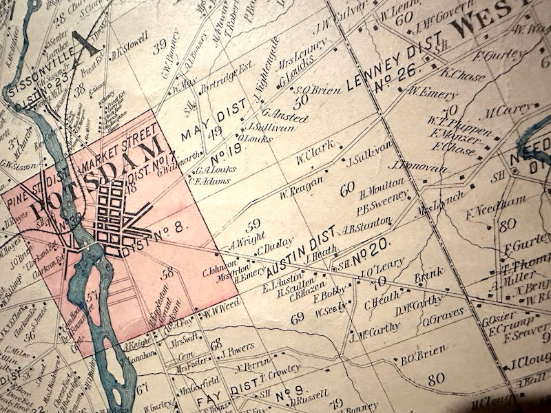
Ian LamontI recently got back from Northern New York, where I stayed at The Sherman Inn, a wonderful history-themed B&B located in a former elementary school. One of the rooms has a gigantic county map from 1896 which includes a special feature - owners' surnames for every house and farmstead located on rural roads (see sample above).
You can imagine how valuable this information is to any genealogist researching ancestors who lived in the area. Here are 4 ways that old maps can help genealogists:
- Although it does not include street numbers, the positioning of the house markers is enough to determine where a home or farm was located relative to other geographic features, intersections, and neighboring properties. You can use this information to find the location on modern maps, including Google Maps.
- Old maps may include illustrations of famous buildings in each of the larger towns. An earlier county map from 1858 shows the Eagle Block in Ogdensburgh, New York. It was a hive of commercial activity, judging by all of the carriages and stores. Note the names of the store’s owners on the signage, a way to identify ancestors who were small business owners.

- Old county maps typically show town, village, and city borders. So, if family lore has an ancestor growing up on a farm south of Potsdam, it’s possible to see if the family home was located within the village of Potsdam, or in the neighboring towns of Parishville or East Pierrepont. Such information is key for getting copies of vital records from local town clerks, or digging up legal or property records.
- I’ve found that many properties on the maps have nearby neighbors sharing the same surname. This opens up new lines of research to determine if they are related, information that can answer family history questions and help break down brick walls.

Old county and town maps can be found online, at local historical societies, and in libraries. The map shown above is an insurance map from the library in my hometown. They are fun to look at, and can connect your ancestors to a specific place and time in the distant past!
")

")
 (PDF)")
")
")
")