Funny maps through the ages: Examples of satiric cartography
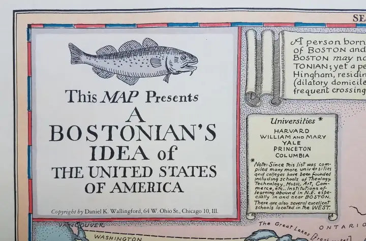
Ian LamontIf you like funny maps, and you like American history, this tongue-in-cheek 1935 map titled “A Bostonian’s Idea of the United States of America” is sure to generate a chuckle:

In addition to Cape Cod ballooning in size, only the New England states and a few Canadian provinces are acknowledged. New York City is no bigger than Concord, and inset text notes “Western cities are reputed to be modern,” while placing Denver and Omaha somewhere north of San Francisco.
The map’s creator, industrial designer Daniel Kirkwood Wallingford (1890-1964), was a Midwesterner who practiced satiric cartography. Not much is known about Wallingford’s life, but in the maps he “gently skewered the chauvinism of the inhabitants of Boston and New York” whilst living amongst them.
Pictorial maps that incorporate satire have a long history in this country. The Official Texas Brags Map of North America (1948) places the Lone Star state at the center of attention:

In the 1800s political cartoonists often incorporated maps, such as this 1888 map depicting Secretary of State and one-time presidential candidate James G. Blaine as the head of a tapeworm made up of various government scandals:

Maps from a different perspective
Of course, unfunny maps also champion their own perspectives, from ancient times to the present day. Identity is asserted, often in ways that seem strange to people from other cultures. This 1816 Japanese map places Kyoto (Japan’s Imperial capital from 794 to 1868) at the center, and refers to the Americas on the right panel as the “Eastern Hemisphere”:

For genealogists, maps are crucial to not only understanding the perspectives of the day, but practical details of where people lived. Check out 4 ways old maps can help genealogists from our blog and also browse the extensive collection of free historical maps hosted by the Library of Congress.
")

")
 (PDF)")
")
")
")